
Why Road Projects Cannot Move Forward Without a Construction Surveyor
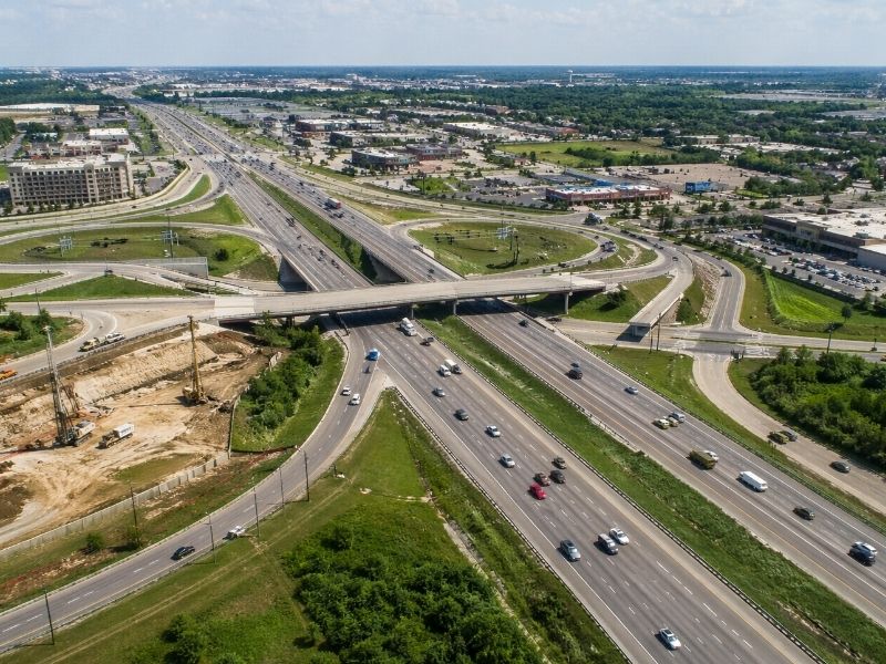
Road projects do not begin with asphalt or heavy equipment. They begin with accurate measurements. Before crews grade land, install utilities, or pour concrete, a construction surveyor marks the exact locations, elevations, and alignments needed for the project to work safely and correctly.
Road Projects Depend on Accurate Measurements
Road construction leaves little room for error. Even a small mistake can create major delays, drainage issues, or safety concerns later.
Construction surveyors help crews understand:
- where the roadway begins and ends
- how high or low the pavement should sit
- where drainage should flow
- where underground utilities run
- where sidewalks, curbs, and lanes belong
Without clear layout points, crews risk building in the wrong location.
A road built too low may collect standing water. A curb placed incorrectly may block drainage. Utility conflicts can stop an entire project for days.
That is why construction surveying matters from the start.
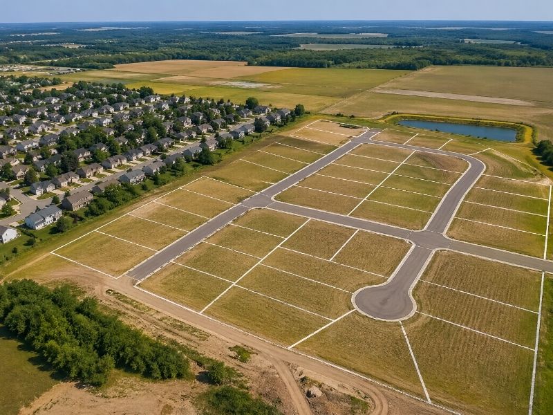
Construction Surveyors Help Before Work Starts
Many people think surveyors arrive after construction begins. In reality, they often visit the site long before crews break ground.
Construction surveyors help verify:
- property boundaries
- existing road conditions
- utility locations
- drainage paths
- elevation changes across the site
This information helps engineers finalize plans using real site conditions instead of assumptions.
Road plans may look simple on paper, but actual job sites rarely match perfectly. Slopes, buried utilities, drainage systems, and nearby structures can all create unexpected problems.
Surveyors help identify those issues early so contractors can avoid expensive corrections later.
Drainage Problems Can Ruin a Road Project
Water is one of the biggest threats to roadway performance.
If a roadway sits too low or grading slopes the wrong direction, water can collect on the pavement instead of draining properly. Over time, that weakens the road surface and creates safety risks for drivers.
Construction surveyors continuously check elevations throughout the project to help crews maintain proper grading.
That process helps ensure:
- stormwater flows toward drains
- intersections stay clear of standing water
- sidewalks drain correctly
- pavement lasts longer
Even a few inches can change how water moves across a site.
Utility Installation Requires Precise Survey Layout
Road projects involve much more than paving.
Crews often install or relocate:
- water lines
- sewer systems
- storm drains
- electrical conduits
- communication or fiber lines
Every one of those systems requires exact placement.
Construction surveyors mark the proper locations before excavation begins. They also help crews avoid conflicts between underground systems.
One mistake underground can delay an entire project. Damaged utility lines often lead to emergency repairs, added costs, and safety concerns.
Accurate survey layout helps reduce those risks.
Construction Stakes Keep Crews Aligned
Road projects rely heavily on layout markers placed throughout the site.
Those stakes and flags help crews identify:
- elevations
- roadway alignment
- grading targets
- offsets
- utility locations
Heavy equipment operators use those markers every day during grading, excavation, and paving.
However, active construction sites constantly disturb layout points. Equipment may run over stakes. Dirt piles may cover them. Rain may wash them away.
Because of that, surveyors often return multiple times throughout the project to reset and verify layout points as work progresses.
Bad Layout Creates Expensive Delays
Road construction already faces challenges like weather delays, traffic control issues, and material shortages.
Poor survey layout creates even bigger problems.
Imagine crews:
- paving outside the approved alignment
- pouring sidewalks at the wrong elevation
- installing drainage pipes that do not connect properly
Fixing those mistakes often means removing completed work and rebuilding it.
That wastes both time and money.
Construction surveyors help reduce those risks by checking measurements throughout every phase of the project.
Modern Surveying Technology Improves Accuracy
Today’s construction surveyors use advanced tools to improve efficiency and precision.
Many projects now rely on:
- GPS survey equipment
- robotic total stations
- drone mapping
- digital terrain models
- machine control systems
Some heavy equipment even connects directly to digital survey data so operators can follow elevation targets in real time.
Still, technology alone is not enough.
Construction surveyors must verify measurements, interpret data correctly, and make sure crews follow the approved design throughout the project.
Surveying Helps Protect Nearby Property
Road projects often run close to homes, businesses, parking lots, and private property.
Construction surveyors help ensure work stays within approved limits and property boundaries.
That helps prevent problems such as:
- sidewalks crossing onto private property
- drainage systems extending too far
- retaining walls placed incorrectly
- utility boxes installed outside approved areas
Even small boundary mistakes can create legal and financial issues later.
Accurate survey data helps contractors avoid those problems while protecting nearby property owners.
Accurate Survey Work Helps Projects Move Faster
Some people assume surveying slows construction down.
In most cases, accurate survey work actually helps projects move more efficiently because crews spend less time correcting mistakes.
Good survey data helps:
- grading crews work faster
- paving crews stay aligned
- utility installations fit correctly
- drainage systems function properly
Road construction always comes with challenges. However, reliable survey work helps eliminate many avoidable problems before they become expensive repairs.
That is why construction surveyors remain involved from the beginning of the project to the final layer of pavement.