A licensed land surveyor can prevent costly redesigns by locating the legal property boundaries before design work begins. Instead of relying on online parcel maps or aerial imagery, a licensed land surveyor provides accurate boundary information that architects, engineers, and contractors can use with confidence.
Many redesigns happen because a project is planned using county GIS maps or other reference data that are not intended to establish legal property lines. When the true boundary is later surveyed, buildings, additions, or other improvements may need to be redesigned to meet setback and property line requirements.
Why Doesn’t a Licensed Land Surveyor Rely on Online Parcel Maps?
Because they aren’t surveys. They were never meant to be, and the agencies publishing them usually say so somewhere in a disclaimer nobody reads.
County GIS parcel layers exist mainly for tax assessment. Somebody took deed descriptions, plats and aerial imagery and fitted them together into a continuous map. That fitting process involves stretching, nudging and best-guessing, because the underlying descriptions don’t actually mesh perfectly. The goal was a workable picture of who owns what for billing purposes, not a legally defensible line.
The errors that result vary wildly. In some places a GIS line lands within a few feet of the truth. In others it misses by twenty. Rural parcels with old descriptions tend to be worst.
Aerial imagery adds its own error. Photos get stretched to fit a coordinate grid, and that process distorts. A rooftop in an aerial image can appear shifted several feet from where the building physically stands, especially near the edges of the photo or on sloped ground.
So a line traced from a screen carries the error of the GIS layer, plus the error of the imagery, plus whatever the designer’s tracing added. Those errors stack.
How Does a Licensed Land Surveyor Use Plats and Tax Maps?
They’re better sources, and still not sufficient on their own.
A recorded plat shows how a subdivision was intended to be laid out. It’s a legitimate legal document, and a licensed land surveyor treats it as real evidence. But it doesn’t tell you where the lines landed on the ground once the monuments were set, and it doesn’t show what has happened since. Fences moved. Easements got recorded. A neighbor’s garage went up somewhere it shouldn’t have.
Tax maps rank lower still, since they inherit all the fitting problems of GIS with none of the legal standing.
The gap between a document and the ground is exactly the space a licensed land surveyor works in. They recover the monuments, weigh the evidence and mark where the line actually falls. Nobody else in the process does that, and no software substitutes for it.
How Can a Licensed Land Surveyor Prevent Costly Errors?
The cost of a boundary mistake grows enormously depending on when it’s caught.
Catch it before design starts and it costs nothing. The designer draws the addition in a spot that works.
Catch it during design and you pay for revised drawings. Survivable.
Catch it at permit review and you pay for revised drawings plus the delay. The reviewer rejects the site plan, you order the survey you should have ordered first, then you redraw and resubmit. Add a month.
Catch it after the footings go in and you’re in a different category entirely. A structure encroaching on a setback or a property line can trigger a stop-work order. Fixing it might mean demolition. It might mean buying a strip of land from a neighbor who now understands they have all the leverage. It might mean a variance application that fails.
The survey costs the same at every one of those points. Everything else multiplies.
Why Should a Licensed Land Surveyor Be Involved Before Design?
Because boundary determination is a licensed professional act, and only one person on the project is licensed to perform it.
An architect, an engineer, a contractor and a homeowner can all be wrong about a property line, and the consequences land on the owner. A licensed land surveyor makes that determination and stands behind it professionally.
Owners frequently decline a survey to save money, and that decision usually gets remembered later. So make it deliberately. Ask your designer directly whether they’re working from surveyed data or from an online source, and get the answer in writing.
The responsibility conversation after a boundary error gets uncomfortable fast. It depends on what was agreed, what the designer’s contract says, and whether anyone recommended a survey. Sorting that out afterward is far more expensive than ordering the survey in the first place.
How Does a Licensed Land Surveyor Work With the Design Team?
The sequence that avoids redesign is boring and it works.
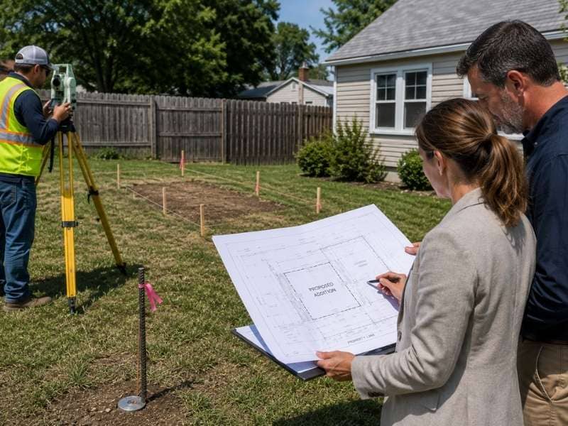
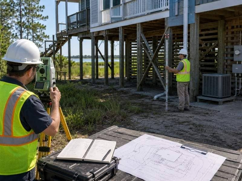
The owner orders the survey first, before any design begins. The licensed land surveyor asks what the project involves, so the scope captures the features the design will actually need. The drawing goes to the designer, who builds the plan on a measured base rather than a traced one. If elevations or drainage matter, the surveyor collects those too, in the same trip.
Everything happens once.
The sequence that causes redesign is the common one. Design first, discover the problem later, survey under pressure, redraw. That path costs more money and more calendar time, and it produces a worse building, because the design gets squeezed into whatever space is left rather than built around the site from the start.
Frequently Asked Questions
Can a Licensed Land Surveyor Verify County GIS Property Lines?
They can measure the true boundary and show you how far the GIS line misses, which is often several feet and sometimes far more. GIS layers get assembled by fitting deeds and imagery together for tax and reference purposes, and most counties publish a disclaimer saying they aren’t survey grade.
Can a Licensed Land Surveyor Use Satellite Imagery to Find Property Lines?
Not as evidence of a boundary. Aerial and satellite images get stretched to fit a map grid, which shifts features from their true positions. Imagery helps a surveyor see context and plan fieldwork. It never establishes a line.
Can an Architect Replace a Licensed Land Surveyor?
No. Boundary determination is a licensed surveying act, and architects, engineers and contractors aren’t licensed to make that call. A designer can draw a plan on top of surveyed data, but somebody has to produce that data first.
Is a Plat Enough Without a Licensed Land Surveyor?
It helps and it isn’t enough. A plat shows the intended layout of a subdivision, not where the monuments landed on the ground or what has changed since. A surveyor uses the plat as one piece of evidence among several.
When Should You Hire a Licensed Land Surveyor?
Before the designer starts drawing. That single ordering decision prevents nearly every redesign in this category, and the survey costs the same whether you order it first or last.

 Land Surveyors are professionals who make precise measurements to determine the size and boundaries of a piece of real estate. While this is a simplistic definition, boundary surveying is one of the most common types of surveying related to home and land owners. If you fall into the following categories, please click on the appropriate link for more information on that subject: