
Boundary Survey Explained: What Developers Need to Know
A developer purchased a lot, pulled permits, and started grading. Three weeks in, a neighbor produced a deed showing the new retaining wall sat four feet onto his property. The project stopped. Lawyers got involved. The fix cost more than the survey would have by a factor of twenty.
That’s not a horror story. That’s a pattern.
A boundary survey is one of the cheapest risk-management tools in development. Most developers who skip it don’t skip it out of ignorance. They skip it because they’re moving fast, the title looks clean, and the lot looks obvious. That’s exactly when it bites.
What Is a Boundary Survey?
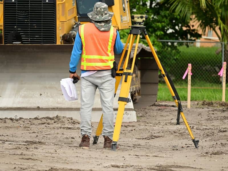
A boundary survey is a formal determination of a property’s legal boundaries. A licensed land surveyor researches the deed, plat records, and historical documents, then physically measures and marks the corners of the parcel on the ground.
The result is a legal document, often called a survey plat or boundary survey map, that shows exactly where your property starts and ends.
How It Differs From Other Survey Types
This matters because “survey” gets used loosely.
- Topographic survey: Maps elevation and terrain features. It doesn’t establish legal boundaries.
- ALTA/NSPS survey: A more thorough version typically required for commercial transactions. Includes easements, encroachments, and improvements.
- Construction survey: Guides the placement of structures during building. Not the same as establishing your legal boundary.
- Mortgage inspection: What many lenders order at closing. Not a full boundary survey. It won’t hold up in a dispute.
If someone hands you a mortgage inspection and calls it a survey, ask follow-up questions.
Why Developers Specifically Need One
Developers aren’t just buying land to sit on it. The stakes are higher because the margin for error is smaller.
Before You Buy
Title insurance covers ownership gaps. It doesn’t cover physical encroachments you could have found with a survey. If the seller’s fence is two feet into the adjacent parcel, or if an access easement cuts through your planned building footprint, a title search alone won’t catch that.
A boundary survey before closing tells you what you’re actually getting. It also gives you negotiating power. Encroachments and easements that show up after the fact become your problem. The ones you find before closing become someone else’s.
Before You Break Ground
Zoning setbacks, utility easements, and building envelopes are all calculated from property lines. If those lines are wrong or assumed rather than confirmed your site plan is built on a guess.
Permit offices in most jurisdictions require a current survey before issuing certain development permits. Even where they don’t, your architect and civil engineer need accurate boundary data to place structures correctly. Errors at this stage compound. A wall poured in the wrong location doesn’t move cheaply.
What the Process Actually Looks Like
Hiring a surveyor isn’t complicated, but knowing what to expect helps you plan around it.
What a Licensed Surveyor Does
The surveyor starts with research, not fieldwork. They pull your deed, the adjoining deeds, recorded plats, and any available historical surveys. This document research often takes as long as the field work.
Then they go to the property. They locate existing monuments (iron pins, concrete markers, or references noted in the deed), measure angles and distances, and reconcile what they find in the field with what the documents say. When there are conflicts between deeds and physical evidence, that’s where professional judgment and state law determine which governs.
Finally, they set new monuments at the corners if they’re missing or disturbed, and prepare the plat.
What You Get at the End
A signed and sealed survey plat showing:
- The legal boundaries of the parcel
- Corner monument locations
- Any encroachments found
- Easements of record
- Adjoining parcel identifications
- The basis of bearings and the surveyor’s legal certification
This document is what your attorneys, engineers, and permit offices will reference.
Common Problems Boundary Surveys Catch

These come up more often than most buyers expect:
Fence line discrepancies. Fences are almost never on exact property lines. Sometimes they’re a few inches off. Sometimes they’re several feet off, and someone has been using land that legally belongs to a neighbor for decades long enough in some states to raise adverse possession questions.
Overlapping deeds. Older subdivisions sometimes have deed descriptions that simply don’t add up when you plot them mathematically. You own what the legal description says, not what a plat drawing implies.
Unrecorded easements. A utility line running through your parcel may or may not be reflected in recorded documents. The survey won’t catch unrecorded verbal agreements, but a careful surveyor will note visible evidence of use.
Lot line gaps. Sometimes parcels were created with gaps between them, or the original subdivision left a sliver of unincorporated land. These can block your access, affect your setback calculations, or create title issues down the line.
How Much Does a Boundary Survey Cost?
Range varies significantly by location, lot size, terrain, and how much document research is required. In the U.S., a residential boundary survey typically runs $500 to $2,500. Rural or irregular parcels can run higher. An ALTA survey for a commercial transaction often starts around $2,000 and scales with complexity.
Get quotes from at least two licensed surveyors in the jurisdiction. Cheaper isn’t always worse, but ask specifically what’s included. Some quotes cover only fieldwork. Others include full monument placement and plat preparation.
How to Choose the Right Land Surveyor
License matters most. Verify that your surveyor holds a current Professional Land Surveyor (PLS) license in the state where the property sits. Licensure is state-specific.
Local experience matters second. A surveyor who knows the county’s recorded plats, the local monument conditions, and the common deed description quirks in that area will work faster and catch things an out-of-area surveyor might miss.
Ask for references from similar projects. A surveyor who primarily does residential mortgage surveys may not be the right call for a multi-parcel commercial assembly.
Frequently Asked Questions
1. Is a boundary survey required by law before buying property? Not always required, but often smart. Some lenders require an ALTA survey for commercial transactions. Residential purchases rarely mandate one. That gap in requirements is where problems get purchased.
2. How long does a boundary survey take? Two to four weeks is typical for a straightforward residential parcel. Complex parcels, disputed boundaries, or heavy research workloads at the surveyor’s office can push that to six to eight weeks. Plan for this in your due diligence timeline.
3. What’s the difference between a boundary survey and an ALTA survey? An ALTA/NSPS survey follows a national standard set jointly by the American Land Title Association and the National Society of Professional Surveyors. It includes more items by default, including easements, utilities, and improvements. Lenders and title companies often require it for commercial deals.
4. Can a boundary survey be used in a legal dispute? Yes. A survey by a licensed PLS is a legal document that carries evidentiary weight in court. It’s not the final word (boundary disputes can be complex), but it’s the starting point any attorney or judge will ask for.
5. Does a boundary survey expire? There’s no universal expiration, but surveys become stale. If significant time has passed, if monuments may have been disturbed, or if adjacent parcel activity has occurred, a new survey is warranted. Most title companies have their own standards often five to ten years before requiring a new or updated survey.