
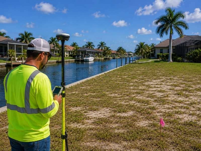
The Survey Step Buyers Miss When Comparing Waterfront Lots
Two waterfront lots can look nearly identical online. Same neighborhood. Similar water frontage. Close in price. But once a buyer gets the survey data for each one, the picture often changes fast.
A property survey gives buyers the kind of detail that listing photos simply can’t show. And when it comes to comparing lots near canals, that detail can make the difference between a good buy and a costly mistake.
Why a Property Survey Makes It Easier to Compare Waterfront Lots
A property survey shows the true size and shape of a lot. It gives buyers exact measurements instead of estimates. That matters when two listings look similar but the actual usable land is different.
Listings show square footage, but square footage alone doesn’t tell the whole story. A survey shows where the land actually starts and ends, how deep the lot runs from the street to the water, and how wide it is at different points. When buyers compare two lots side by side using survey data, they’re comparing real numbers. That’s a much more reliable way to make a decision.
How Lot Shapes Can Be Different Near Canals
Waterfront lots near canals are not always the same shape, even when they sit right next to each other. Some lots taper toward the water. Others widen at the back. A few have irregular corners or angles that reduce the usable area more than the square footage suggests.
This matters because the shape of a lot affects what you can do with it. A wide, rectangular lot gives a buyer more options than a narrow, tapered one of the same size. Without survey data, buyers often assume both lots work the same way. That assumption doesn’t always hold up once the lines are drawn on the ground.
What to Check Before Adding a Dock or Other Features
Buyers who plan to add a dock, a pool, or any structure after closing need to know exactly where the open space on the lot sits. A survey shows this clearly.
It records where existing structures are located and how much space remains between those structures and the property lines. That information helps buyers figure out whether their plans are realistic before they close, not after. Skipping this step means making decisions based on guesses. A lot that looks spacious in a photo might have less room than expected once the existing footprint and setback distances are mapped out.
Why Property Lines Matter More Than Listing Photos
Listing photos show what a lot looks like. They don’t show where it ends.
Photos can make a lot appear larger than it is. They can also hide the fact that a neighboring structure, a fence, or a paved area sits very close to the actual property line. Buyers who rely only on photos sometimes close on a property and later find out the lot is smaller or shaped differently than they expected.
A survey removes that uncertainty. It shows the exact location of every property line and gives buyers a clear picture of what they’re actually purchasing. That information is especially useful when comparing two waterfront lots that look similar in photos but may be quite different on the ground.
How a Property Survey Can Help You Buy With Confidence
Buyers who review survey information before closing know what they’re getting. They’ve seen the measurements. They understand the shape of the lot. They know where the lines are.
That makes it easier to compare two properties without relying on assumptions. If one lot has more usable depth or a better shape for future plans, the survey shows it. If one lot has a feature the photos didn’t make clear, the survey shows that too.
Reviewing survey data before closing doesn’t slow the process down. It speeds up the decision by giving buyers real information to work with instead of questions they’ll have to figure out later.
Frequently Asked Questions
What is a property survey?
A property survey shows the size, shape, and boundaries of a piece of land. It uses measurements taken by a licensed surveyor to document exactly where the lot begins and ends.
Why do I need a property survey when buying a waterfront lot?
A survey gives buyers verified measurements and boundary locations that listing photos and descriptions can’t provide. That information makes it easier to compare properties and understand what each lot actually includes.
Can two waterfront lots have different shapes?
Yes. Lots near canals and waterfront areas vary in shape, even when they sit next to each other or have similar square footage. The shape affects how much usable space is available and what improvements are possible.
Will a property survey show where the property lines are?
Yes. A survey documents the exact location of every property line based on measurements taken in the field. That’s more reliable than fences, photos, or estimates.
When should I review a property survey?
Before closing. Reviewing survey information while you’re still deciding gives you time to compare lots accurately and ask questions before the purchase is final.