
How Drone Inspection of Erosion Control Supports Faster Compliance Reviews
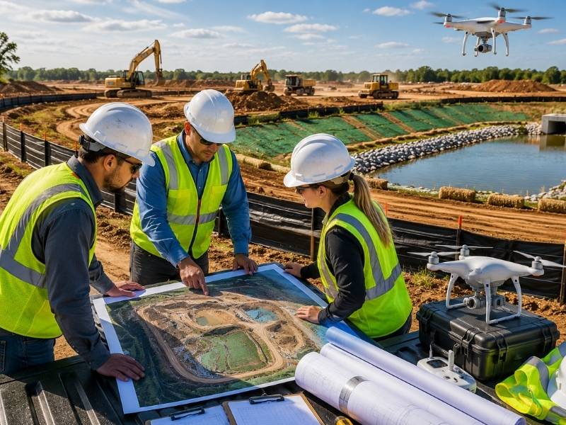
Compliance reviews can slow a construction project down fast. Inspectors need clear records, solid site data, and proof that erosion controls are in place and working. When that information is hard to find or out of date, reviews drag on and approvals get pushed back. Drone inspection of erosion control gives review teams what they need without a lot of going back and forth. Projects that use drone data during the compliance process move through reviews with fewer delays and fewer surprises.
How Drone Inspection Gives Reviewers Better, More Current Site Records
A compliance reviewer’s job depends on having up-to-date, accurate information. If the records don’t match what’s actually on the ground, the review stops while teams go back to double-check details. That gap between paperwork and reality causes a lot of delays.
Drone inspections fix that problem. Each flight takes detailed photos and measurements across the whole site in one pass. The records show what the site looks like right now, not what it looked like during a walkthrough three weeks ago. Reviewers get a clear view of erosion control setups, drainage features and bare soil areas without anyone having to guess or estimate.
When the records going into a review are accurate, reviewers ask fewer questions and spend more time actually moving through the process.
How Drone Data Puts All Erosion Control Information in One Spot
A construction site has a lot going on at once. Silt fences, sediment basins, inlet protections, stabilized access points. All of those controls need to be documented and checked. When that information is spread across separate inspection reports, photos and hand-drawn maps, reviewers spend a lot of time just hunting down and connecting pieces.
One drone dataset covers the full site and shows how all the erosion controls connect to each other and to the land around them. Reviewers can go through that data without jumping between different documents or file types.
Keeping everything in one place also lowers the chance that something slips through. When drainage controls and disturbed soil areas show up together in the same aerial dataset, it’s much easier to check whether coverage is complete and whether controls are installed where they need to be.
Why Drone Mapping Cuts Down on Wait Time During Reviews
The main reason compliance reviews take longer than they should is wait time. Reviewers ask for site information, project teams go out and collect it, and then everyone sits and waits. On a large site, that back and forth can eat up days or even weeks.
Drone mapping cuts that wait down a lot. Aerial surveys cover big areas in a single flight and turn around ready-to-use maps and measurements quickly. Project teams can answer data requests without sending crews back out to walk every part of the site on foot.
When reviewers don’t have to stop and wait for extra site visits or more photos, the whole process keeps moving. Less waiting leads to faster decisions.
How Aerial Views Help Teams Catch Problems Before a Formal Review
Missing or incomplete erosion controls are one of the top reasons a site gets flagged during a compliance review. Spotting those gaps from the ground takes time, especially on large sites where some corners are hard to reach.
From the air, gaps are much easier to see. A drone image of a long silt fence line shows breaks or missing sections right away. A top-down view of a bare slope quickly shows whether soil stabilization covers the area it’s supposed to cover.
Catching those issues before a formal review starts is much better than having a reviewer find them in the middle of an evaluation. Teams that use drone inspection to check for gaps before they submit get a chance to fix things first. That keeps the review on track instead of turning into a back-and-forth over problems.
How Using the Same Drone Format Every Time Speeds Up Reports
When drone surveys follow the same flight path, collect the same kinds of data and deliver results in the same format each time, reviewers get used to it fast. They know where to find what they need, and they stop wasting time figuring out how a report is set up.
That routine builds up over time. A reviewer who has gone through ten drone reports from the same project in the same format will move through the eleventh one much faster. Consistent reports also make it easy to compare site conditions across different review periods. Reviewers can spot what changed between one survey and the next without having to figure out a new layout.
For project teams, a standard format also means less time spent reformatting data or walking different reviewers through how the output works. The reports are set up the same way every time, which keeps the process moving.
Frequently Asked Questions
How does drone inspection help speed up erosion control compliance reviews?
Drone inspection gives review teams current, site-wide data in one organized set of files. Reviewers spend less time asking for extra information or waiting on field visits. Faster access to accurate records keeps the review moving from start to finish.
What types of site data from drone mapping help compliance reviewers?
Aerial photos, elevation models and site measurements all support compliance reviews. They show where erosion controls are located, how much ground has been disturbed, and how drainage features relate to the surrounding land, all without needing an extra site visit.
Why does having all drone data in one place help with erosion control records?
When all site conditions show up in a single aerial dataset, reviewers don’t have to piece together information from separate reports or maps. That saves time and lowers the chance that something gets missed during the review.
Can drone inspection reduce delays in the compliance approval process?
Yes. Drone surveys produce ready-to-use site data quickly, so project teams can respond to reviewer requests without sending crews back out. Less waiting between requests and responses keeps approvals on track.
How does using a consistent drone survey format help erosion control reporting?
Consistent formats make reports easier to read and compare. Reviewers who see the same layout across multiple survey periods find what they need faster and can spot changes between surveys without having to learn a new setup each time.